
The River Caldew,
and Gillcambon Beck, (pronounced "Gill-co-mon")
The River Caldew
Back to the HOME page:
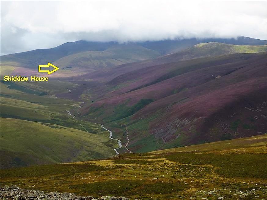
The River Caldew sourses on the area of moorland known as Skiddaw Forrest on the back side of Skiddaw.
Skiddaw is the 4th highest mountain in England. (with a summit 3053ft above sea level).
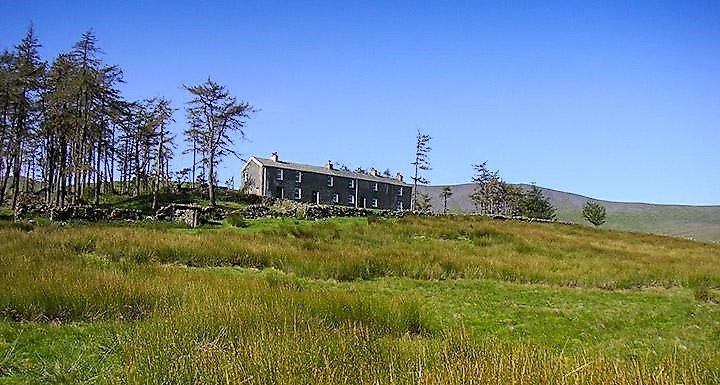
Skiddaw House is the highest altitude youth hostel in the Britain. (1550ft above sea level)
The River Caldew passes close to the village of MILLHOUSE
in it's junior stage, sourcing on the eastern face of Skiddaw, on Skiddaw forest, terminating into the river Eden near the Sheep Mount sports ground, at the lower end of Bitts Park in Carlisle, which in turn feeds into the channel of the River Esk, with a final destination of the Solway Firth.
The Caldew also passes close-by to the villages Mosedale, Haltcliffe Bridge, Hesket Newmarket, Sebergham, Raughton Head, Bridge end/Dalston and Cummersdale, before making it's way through the western side of the city of Carlisle.
The Caldew also passes close-by to the villages Mosedale, Haltcliffe Bridge, Hesket Newmarket, Sebergham, Raughton Head, Bridge end/Dalston and Cummersdale, before making it's way through the western side of the city of Carlisle.


Our stretch of the Caldew has a very unique feature. During periods of low rain fall there are lengthy stretches of the river between Haltcliffe Bridge and Hesket Newmarket which completely dry-up and cease to flow. The smaller volume of river during these times is literally swallowed up by open limestone crevices in the river bed, locally named "Swallow Holes".
Extensive research several years ago by specialists has proven that the water taken in by these "swallow holes" actually flows underground in limestone caverns for a distance of more than 5 miles, the majority reappearing back into the Caldew at Howgill, just upstream from the village of Sebergham. but has also been proven to reappear as far downstream as Bridge End, Dalston.
Probably because of these underground caverns, current and previous farming generations have experienced unexplained, unpredictable minor subsidence and sink-hole events on their land, which have never been fully understood, therefore have escaped publicity.
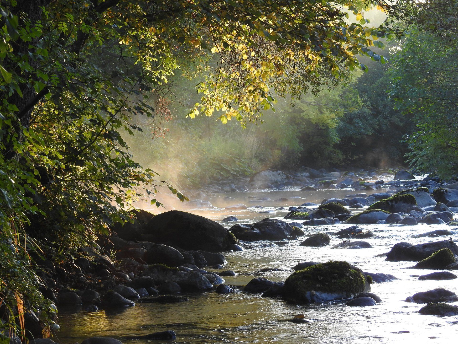
Most of the time, the river Caldew is a picturesque gentle babbler and a pleasure to live alongside.

This photo shows Carrock Beck, on the Northern Fells, following a period of heavy rainfall, which in turn feeds into the Caldew at Haltcliff Bridge.
The main catchment area of the River Caldew is the nearby Northern Fells. The induced rainfall on the Northern Fells enters the water courses and the Caldew’s tributary becks almost immediately with out any form of slow release or delay.
This results in the Caldew raising its level and flow rate quite rapidly.
This rapid rise rate is accelerated when the rain falls on melting ice and snow.
This Characteristic rapid rise rate makes our stretch of the Caldew very unpredictable.
(a) No man-made environmental slow release project would ever prevent this natural action.
(b) No generalised weather forcast or remotely located electronic fast-rise sensor would ever predict how the river Caldew will react to the conditions on the local catchment area of the Northern Fells, therefore we receive little, or no warning.
It remains the belief of some environmentalists, (who in reality, if they were to be completely honest), who have not witnessed the enormity and aggressive nature of a steep gradient river in flood mode first hand, visualize that a steep gradient river in flood mode can somehow be slowed down by so-called slow release, dry dam upstream lagooning and meandering methods.
Those environmentalists should be invited to actually come out from their warm dry classrooms to attend and actually witness reality, and the complete uncontrollable nature of a steep gradient river in flood mode.

The river Caldew in full spate, has a rather frightening, extremely uncontrollable nature.
During these times it veers from its now hindered natural conventional path, to be involuntarily governed only by earth's gravitational force.
If the environmentalists do eventually find the time to witness this for them selves, hopefully, they will be finally convinced that realistically a vigorous steep gradient river, (such as the above, and the Caldew) in fully fledged flood mode just cannot be prevented from flowing through it's unconventionally formed unscheduled gravitational path.
_________________________________________
During the first half of the last century, since the construction of the low capacity bridge was completed, (in 1896), MILLHOUSE
suffered from horrific flooding to properties, sometimes several times a year. The village even took on a nick-name by local people as “the little Hell”. The Caldew used to burst its banks following severe relentless rainfall, and literally just find its own level in the village, with only the high lying properties being spared from the devastating effects.
For more about the history, plus the very realistic negative characteristics of MILLHOUSE
bridge, visit "the Bridges" page. https://www.millhouse-hesketnewmarket.com/the-bridges
The big turning point was in the 1960’s when the "Cumberland River Authority", (as they were then known, before being umbrellaed by the "Environment Agency") dredged the river up stream from the bridge and installed the much welcomed flood defence bank.
To minimise the export and import of any materials during the construction of the bank, an ingenious method was deployed.
To minimise the export and import of any materials during the construction of the bank, an ingenious method was deployed.

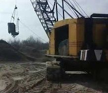
(a) A wide trench was dug in the line of the proposed bank, parallel to the river. The soil from the trench was set aside for use later.
(b) The river was dredged using a long reach Priestman with a cable slung drag bucket. The stones and gravel dredged from the river was heaped in the trench.
(c) The heap was then covered by the preliminary retrieved soil, uniformly shaped and seeded.
(b) The river was dredged using a long reach Priestman with a cable slung drag bucket. The stones and gravel dredged from the river was heaped in the trench.
(c) The heap was then covered by the preliminary retrieved soil, uniformly shaped and seeded.
Further to natural settlement and trampling by livestock, in the early 2000’s this bank was given an extensive upgrade by the Environment Agency to enlarge its profile and height. Extra soil/clay was imported to use for the profile upgrade, and minor dredging of the river was also carried out.

Flooding to the village was endured on a regular basis during the first half of the last century, since the bridge was built in the 1890's.
Since the welcomed completion of the "Flood Defence Bank" in the 1960's by the Cumberland River Authority, MILLHOUSE
enjoyed a holiday, (of over 40 years) from the horrendous river flooding, until the overflow route to the original flood plain was blocked by the construction of a garden wall and raised level drive during 2003/04, causing the first of 4 consecutive flooding events, on the 7th January 2005.
Additional dredging, earth works and reinforcements, (using imported boulders) to the west bank of this stretch of river has also been privately carried out, BUT ONLY for self preservation benefits of the property garden on the west bank.
Because of the newly created up steam stacking caused by the blocked bridge overflow path, in order to compensate, (for the sole benefit & welfare of vulnerable properties of the village) a substantial flood defence bank has had to be privately funded & installed, bordering the caravan site, to protect MILLHOUSE
from unprecedented levels which flowed around the top end of main flood defence bank during the 2005 & 2009 events.
The sooner the original overflow/by-pass for the river Caldew bridge is reinstated, the sooner the properties in MILLHOUSE
will actually become desirable and marketable, (as they used to be).
Sadly, another flooding event and more hardship may have to be experienced before the-powers-that-be individuals are completely convinced about the very realistic and proven facts laid out on the pages of this website.
______________________________________
The Gillcambon Beck, (pronouced "Gill-co-mon").

The Gillcambon beck sources in Greystoke Forest, and terminates into the River Caldew at MILLHOUSE.
In its mature stage, it divides the two parishes of Mungrisdale and Castle Sowerby.
In its mature stage, it divides the two parishes of Mungrisdale and Castle Sowerby.
This is the junction of the Gillcambon beck with the River Caldew, just a few hundred meters upstream from the 122 year old arched MILLHOUSE
Bridge.
