Dry River & Sink Hole,
Summer 2018
Back to the HOME page:
July 2018.
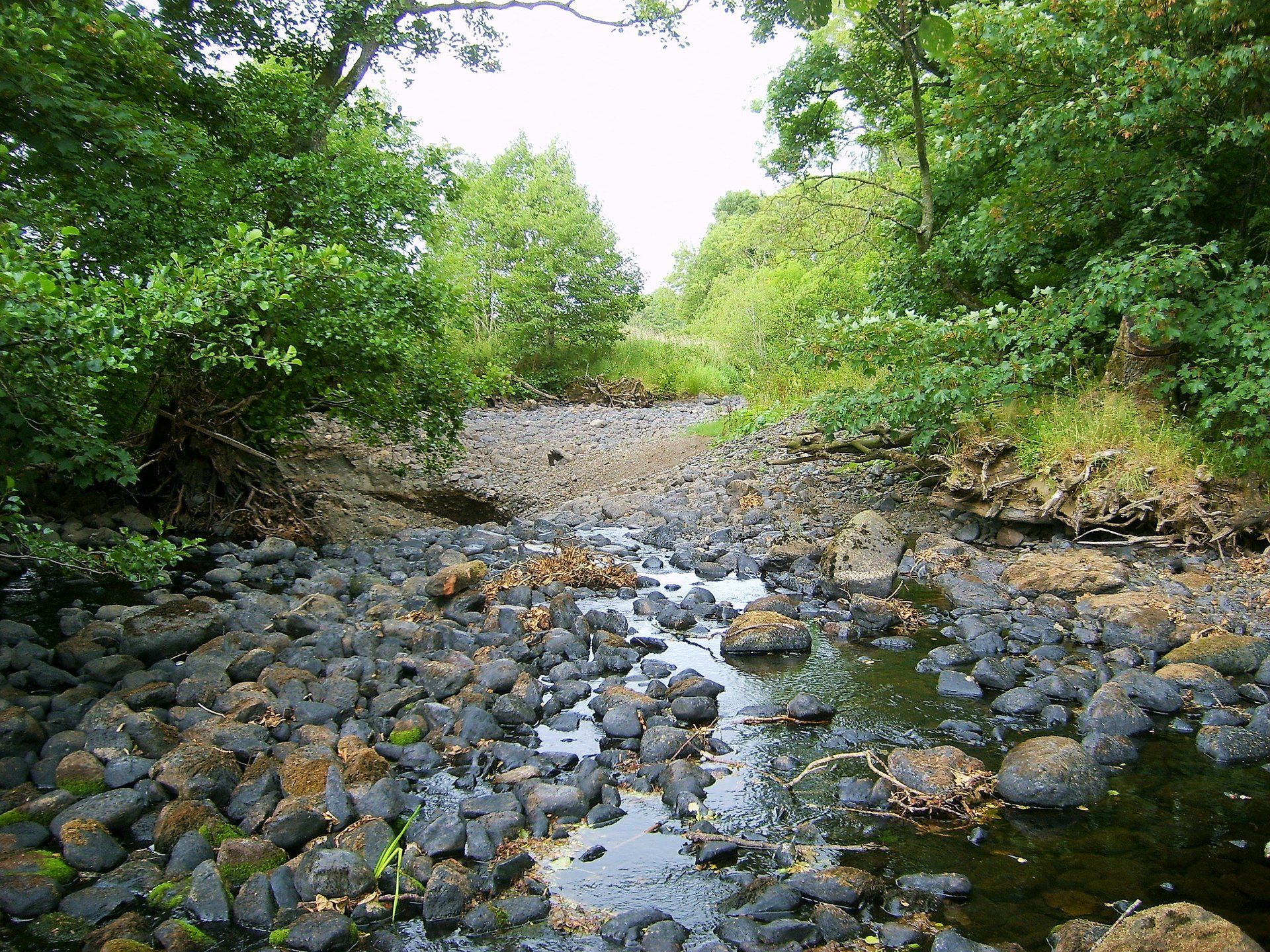
The section of river Caldew adjacent MILLHOUSE has been Completely dry for many Weeks.
The section of river Caldew adjacent MILLHOUSE has been Completely dry for many Weeks.


July 2018
The Caldew has been completely dry adjacent MILLHOUSE for nearly 2 months.
Drier than the previous dry summer of 1976.
The Caldew has been completely dry adjacent MILLHOUSE for nearly 2 months.
Drier than the previous dry summer of 1976.
It can now be revealed that the reason for the unexplained dry river is because of a giant "Sink Hole" which has recently opened up in the river bed, half a mile up-stream.
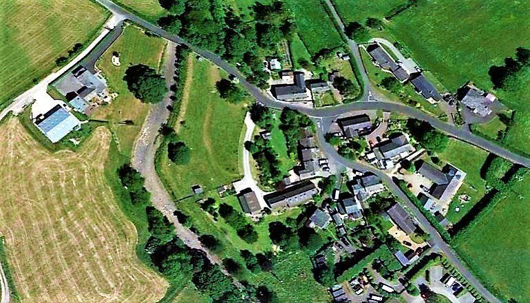
Below is an aerial image with an arrow indicating the sink hole location,
1/2 mile up-steam from MILLHOUSE.

The water of the river Caldew in the foreground will disappear down the newly established "Sink Hole" location, (shown on the next photo) and travel underground in limestone caverns until two re-entry points in the Caldew, the first at Howgill near Sebergham, (5 river miles) and also Bridge End Dalston, (9 river miles).
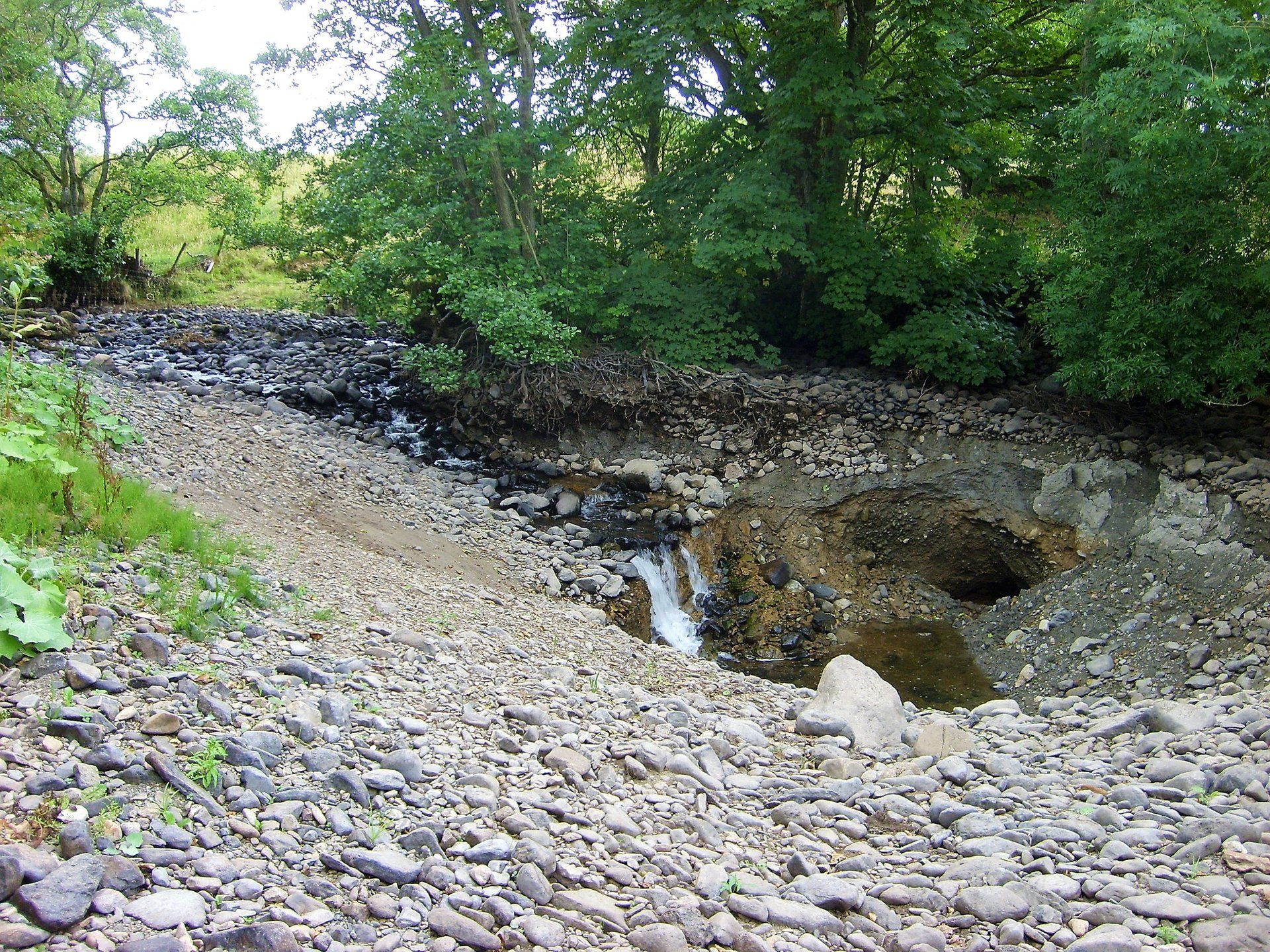
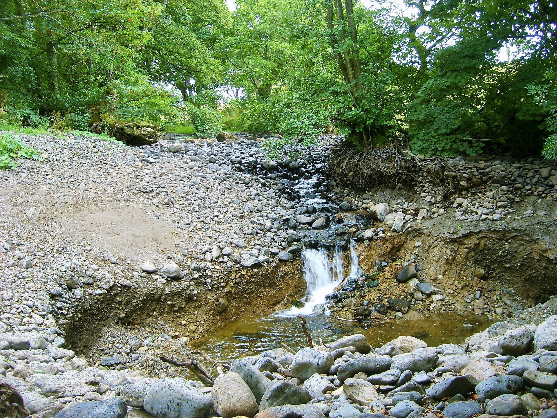
The recently established giant "Sink Hole" half a mile up-stream from MILLHOUSE
is now taking the full flow of the River Caldew.
The Caldew is now entering the already established, but quite unique local underground cavern network, through this newly established limestone crevice in the river bed.
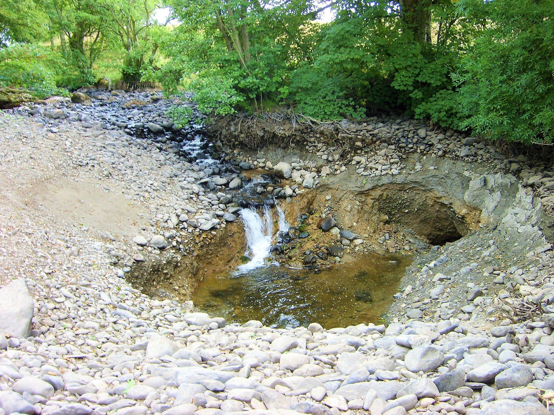

The water entering the "Sink Hole" will remain in the underground limestone cavern network, until the re-entry point in the Caldew at Howgill, just upstream from the village of Sebergham.
The river Caldew is completely dry from this point down until the Water Meetings near Parsons park, (4-5 miles downstream) where the tributary "Cald" beck enters the Caldew.
A spokesman for the Environment Agency said: "The Agency is investigating after receiving the report of the sink hole in the Caldew. The Agency will investigate and see what action needs to be taken to protect people and the Environment."
The worry to many of the local people is that children have been using the sink hole site unsupervised, as a recreational swimming pool, totally oblivious to it's unstable nature.
________________________________________
The River Caldew passes close to the village of MILLHOUSE
in it's junior stage, sourcing on the eastern face of Skiddaw, on Skiddaw forest, terminating into the river Eden near the Sheep Mount sports ground, at the lower end of Bitts Park in Carlisle, which in turn feeds into the channel of the River Esk, with a final destination of the Solway Firth.
It also passes close-by to the villages Mosedale, Haltcliff Bridge, Hesket Newmarket, Sebergham, Dalston and Cummersdale, before making it's way through the western side of the city of Carlisle.
It also passes close-by to the villages Mosedale, Haltcliff Bridge, Hesket Newmarket, Sebergham, Dalston and Cummersdale, before making it's way through the western side of the city of Carlisle.
Our stretch of the Caldew has a very unique feature. During periods of low rain fall there are lengthy stretches of the river between Haltcliff Bridge and Hesket Newmarket which completely dry-up and cease to flow. The smaller volume of river during these times is literally swallowed up by open limestone crevices in the river bed, locally named "Swallow Holes". Extensive research, (several years ago) by specialists, has proven that the water taken in by these "swallow holes" actually flows underground in limestone caverns for a distance of more than 5 miles, the majority reappearing back into the Caldew at Howgill just upstream from the village of Sebergham. but has also been proven to reappear as far downstream as Bridge End, Dalston.
_____________________________________
The aerial image below, dated 30th June 2018,
clearly shows the dry river bed adjacent MILLHOUSE.